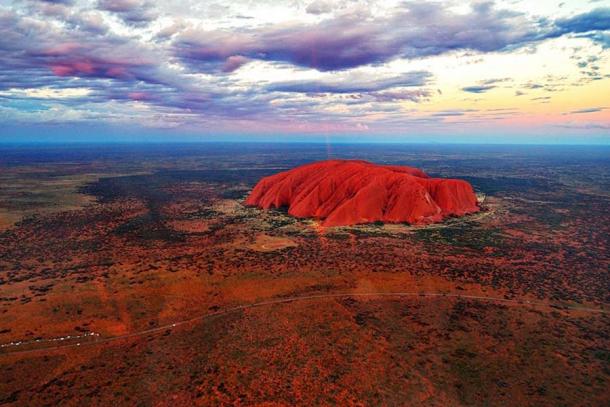
Uluru, once known as Ayers Rock, is one of Australia’s most iconic landmarks. Located in the Northern Territory of Australia, it is the single largest monolith rock in the world. At a staggering height of 346 meters (1135 feet) and running about 3.2 kilometers (2 miles) in length and width, this sandstone rock formation towers over an otherwise completely flat terrain. Uluru, which means ‘great pebble’, carries great spiritual and cultural significance for the Aboriginal tribes of this region.
Looking at the vast desert plain around Uluru, it is hard to believe it was once underwater. The monolith was formed around 500 million years ago when the earth’s plates were shifting and due to a burst in pressure, the giant rock formation was formed. The rock is homogeneous, and as a result there is no soil on it. Its creation, material, and size make it one of the most significant sites for geologists.
One of its most notable features is the spectacular way in which it changes color as the sun reflects off the minerals within the rock. Full of caves, canyons, cracks, water holes and other natural formations, as well as ancient rock paintings and carvings, Uluru, and the surrounding national park, was added to the UNESCO World Heritage List in 1987 for its important natural values. In 1994, it was also added to the list for its extraordinary value as a living cultural landscape.

Aerial view of Uluru at sunset. (Dimageau / CC BY-SA 4.0 )
Early European Explorers
In 1788, European colonizers arrived in Australia and began subjugating the Aboriginal people. The indigenous people lost most of their land and sacred sites, and many were murdered, died from introduced diseases, or were taken as slaves.
European explorers undertook expeditions to discover the vast territories of the continent and find new lands for agriculture. In 1873, British explorer William Gosse became the first non-Aboriginal person to see Uluru, naming it Ayers Rock after the Chief Secretary of South Australia, Sir Henry Ayers.

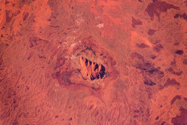
Satellite picture of Uluru. (Astro_Alex / CC BY-SA 2.0 )
The Legendary Creation of Uluru
According to the local legends, Uluru is believed to have resulted from the intervention of ancestral beings or gods, when the divine beings emerged from the void and created all life on earth. To the Aboriginals, this time is known as the Dreamtime. It is said that two tribes of these ancestral beings had a battle to the death in this area over a beautiful lizard woman. As the result of this battle, the earth rose in grief and thus Uluru was created.
Each region of Uluru was believed to have been formed by a different ancestral spirit. The southern site was said to have been created due to a war between the poisonous and carpet snakes. The northwest side was created by Mala, the hare wallaby people, and another area was formed by the Tjukurpa of Kuniya, the sand python, who went dancing across the rock.

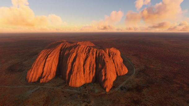
An aerial view of Uluru. ( Aleksandr / Adobe Stock)
Why Uluru is Important
This monolith is an important and sacred place for the Aboriginals in Australia —in much the same way Titicaca is for South American tribes. Archaeological evidence has shown that the Aboriginals have lived in the region of Uluru for at least 30,000 years. Uluru is still a cultural landscape and, to the Aboriginal people, it is a living, breathing landscape and a resting place for ancestral spirits. Cultural customs and traditions are handed down and link the people with the land and animals.
The Anangu Aboriginal people are guided by Tjukurpa (law) to keep both culture and country strong. This is something that has never changed.
There are a number of sacred locations on and around Uluru, which were used by the indigenous people for ceremonies, teaching, and daily activities:
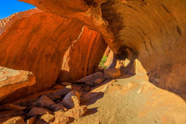
- Kulpi Mutitjulu (Mutitjulu Cave) – A place where Aboriginals would share and distribute food caught during the day, and teach children Dreamtime stories. This is reflected in the rock art within the cave.
- Taputji – Separate from Uluru on the northeast side, Taputji was an ancient hunter-gatherer location used for collecting food and plants.
- Tjukatjapi, Pulari, and Mala Puta – Located on the north, northwest, and south sides respectively, they are sacred sites for the women.
- Warayuki – Acave-like site on the north side of Uluru which is sacred to the Anangu men
- Kuniya Piti – Sacred men’s site located on the far east side of Uluru with similar sacred rock carvings and features to Mala Puta and Pulari.

The Kitchen Cave along Mala Walk at base of Uluru. ( bennymarty / Adobe Stock)
Return to the Aboriginal People
During the time of European colonization, the Aboriginal people were actively discouraged from visiting the area and their culture and rituals were largely ignored. The Australian government promoted “Ayers rock” as a tourist site. Over the decades, millions of tourists flocked to the monolith to climb it, trampling over sacred territories and leaving rubbish and damage behind.
However, as attitudes began to change, and following years of campaigning and lobbying to the government, the Anangu were finally recognized as the traditional owners of the land in 1985. The Australian Government handed the title deeds to the park back to their rightful owners and in 1995, out of respect to the traditional owners, the park name was officially changed from Ayers Rock to Uluru-Kata Tjuta National Park. On 26 October 2019, climbing Uluru was officially banned.
Top image: Australia’s Uluru. Source: bennymarty / Adobe Stock
By Joanna Gillan


